
How Topographic Surveying Supports Waterfront Flood Mitigation and Utility Relocation
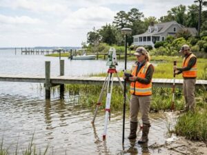
Topographic surveying provides the elevation data that waterfront flood mitigation and utility relocation both depend on. Protecting a shoreline area from flooding means building walls, gates and other defenses at precisely the right heights. Moving the utilities out of harm’s way means knowing exactly where everything sits. Both efforts run on detailed measurements of a complex, built-up waterfront, and the survey is what supplies them.
Building an Elevation Model Across the Waterfront Project Area
The survey captures the full shape of the waterfront, which is more varied than most sites. Crews measure elevations across streets, plazas, buildings, walls and the shoreline itself. Together these build a detailed model of how the whole area sits relative to the water.
Waterfront ground changes elevation in ways that matter. A plaza might sit just a foot above high water, while a street behind it climbs gradually away. Those small differences determine where flooding enters first and how far it spreads. The model captures them precisely.
Buildings and structures anchor the picture. Crews record the elevations of building entrances, ground floors and any features where floodwater could get in. This information shows which structures face the most risk and where protection matters most.
Locating Floodwalls, Outfalls, and Existing Protection Features
The survey documents whatever flood protection already exists. Crews locate floodwalls, bulkheads, gates, berms and any other structures currently defending the area. Each one gets measured for position and elevation.
Existing protection often has gaps. A floodwall might stop short, sit too low in places, or have openings for access that let water through. Mapping the current defenses precisely reveals where they succeed and where they leave the area exposed.
Outfalls need careful attention too. These are the points where drainage systems discharge toward the water, and they can let flooding back into an area if not managed. The survey locates them and records their elevations, since they affect how any new protection has to be designed.
Finding Low Openings and Potential Tie-In Points
Flood protection only works if it forms a continuous line, so the survey hunts for the weak points. Crews identify low openings where water could get past the defenses, including doorways, road connections, gaps in walls and other spots that sit below the protection level.
Every low point is a potential failure. A single doorway or driveway lower than the surrounding wall can let floodwater into an area that’s otherwise protected. Finding these openings through careful measurement lets the design address each one.
Tie-in points connect new work to old. Where new flood protection meets existing walls or higher ground, those junctions have to be seamless. The survey provides the elevations that let engineers design connections without gaps, keeping the protective line unbroken along its whole length.
Planning New Routes for Displaced Utilities
Flood mitigation often forces utilities to move, and the survey guides that relocation. Building floodwalls, raising ground or reshaping the shoreline can conflict with existing water, sewer, electrical and communication lines. Those systems have to be rerouted around the new work.
Accurate positions make relocation possible. The survey provides both the horizontal locations and the elevations of existing utilities, showing where they currently run. Engineers use that information to plan new routes that avoid the flood protection and each other.
Elevation drives utility design especially. Gravity sewer and drainage lines depend on maintaining their slope, so their new routes have to work with the ground’s elevations. The survey gives engineers the vertical information they need to reroute these systems while keeping them functioning.
Verifying the Completed Flood-Protection Elevations
Once construction finishes, the survey confirms that everything reaches the intended heights. Crews measure the completed floodwalls, gates, berms and raised areas, then compare them against the design. This verification proves the protection will perform as planned.
Elevation accuracy is the whole point of flood protection. A wall built even slightly too low fails at exactly the moment it’s needed most. Measuring the finished heights confirms that each part of the system reaches the required level, with no weak sections.
Relocated utilities get checked too. Crews verify the positions and elevations of the moved systems, confirming they were installed correctly and clear of the flood protection. The completed survey documents the finished project, giving the owner a record of what was built and proof that it meets the flood requirements it was designed for.
For a free land surveying quote, call us at (571) 200-5708 or send us a message by going here.
Posted in Topographic surveying
