
Land Survey Types Explained: Finding the Right One for Your Property
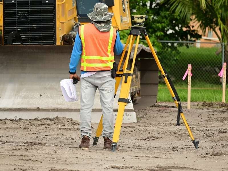
Not all land surveys are the same. Each type serves a specific purpose, and ordering the wrong one can cost you time, money, and legal headaches. Whether you are buying a home, planning a construction project, or dealing with a property dispute, knowing which survey fits your situation is the first step in the right direction.
The United States conducts over 1.5 million land surveys every year, according to the National Society of Professional Surveyors, with most of them tied to residential and commercial building activity. Here is a clear breakdown of the most common types and when each one applies.
1. Boundary Survey
A boundary survey identifies the exact legal edges of a property. It is the most frequently ordered survey type in the country and is often the starting point for any property-related decision.
A licensed surveyor reviews public records, deeds, and historical documents, then physically locates and marks each corner of the property. The result is a legal description of your boundaries that holds up in court, in real estate transactions, and in permit applications.
You need a boundary survey when:
- Buying or selling a residential property
- Building a fence, shed, deck, or addition
- Settling a disagreement with a neighbor about property lines
Average cost: $300 to $900 for up to half an acre
2. Topographic Survey
A topographic survey maps the physical features of a piece of land. This includes slopes, elevations, trees, water bodies, and any existing structures. It does not focus on legal boundaries. Instead, it gives designers and builders an accurate picture of what the land actually looks like.
Architects, engineers, and contractors rely on topographic surveys before starting any project that involves grading, drainage, or structural design. Without this data, a building plan is essentially built on guesswork.
You need a topographic survey when:
- Designing a home addition or new construction
- Planning drainage or grading work on a property
- Applying for permits that require terrain data
Average cost: $400 to $1,500 depending on acreage and terrain
3. ALTA/NSPS Survey
An ALTA/NSPS survey is the most thorough type of land survey available. It meets the standards set by the American Land Title Association (ALTA) and the National Society of Professional Surveyors (NSPS). Lenders and title companies commonly require this survey before approving financing on commercial properties.
This survey goes beyond boundary lines. It documents easements, encroachments, rights-of-way, utilities, zoning classifications, and improvements on the property. Because of its depth, it gives all parties in a commercial transaction a complete and accurate picture of what they are dealing with.
You need an ALTA/NSPS survey when:
- Closing on a commercial real estate purchase
- A lender or title company requires it for financing
- Making a large-scale real estate investment
Average cost: $2,500 to $3,000 or more for larger properties
4. Construction Staking Survey
A construction staking survey takes a building plan off paper and places it on the ground. Surveyors install physical stakes and markers to show contractors exactly where to build, dig, and grade.
This type of survey is critical for keeping a project legally and physically aligned with the approved plans. It prevents buildings from being placed on the wrong spot, which can trigger costly demolitions, permit violations, or disputes with neighboring property owners.
You need a construction staking survey when:
- Breaking ground on any new structure
- Installing roads, drainage systems, or utilities
- Any project where precise placement of improvements is required
Average cost: Varies based on project size and complexity
5. Subdivision Survey (Plat Survey)
A subdivision survey divides a large parcel of land into two or more smaller lots. The result is a legal plat map that must be reviewed and approved by the local government before any of the new lots can be sold or developed.
This survey defines the boundaries of each new lot, identifies shared easements, and maps out roadways and utilities that will serve the subdivision. It is a required step in any land development project and in many estate planning situations where land will be divided among heirs.
You need a subdivision survey when:
- Splitting land for development or sale
- Applying for local subdivision approval
- Dividing an inherited property among multiple parties
Average cost: $300 to $1,000 depending on the number of lots
6. Mortgage Survey (Title Survey)
A mortgage survey, sometimes called a title survey, is ordered by lenders and title companies to confirm that a property’s physical boundaries match its legal description in public records. It protects the lender’s investment by identifying encroachments, boundary issues, or discrepancies before a loan is approved.
This survey is not always ordered by the property owner. In many cases, the lender requires it as part of the financing process. It is also commonly needed during refinancing.
You need a mortgage survey when:
- Financing the purchase of a home
- Refinancing an existing mortgage
- A title company requires it before issuing title insurance
Average cost: $1,500 to $4,500
7. Flood Elevation Certificate Survey
A flood elevation certificate survey measures the elevation of a structure in relation to the Base Flood Elevation (BFE) set by FEMA. It is required for properties located in FEMA-designated flood zones and plays a direct role in determining flood insurance premiums.
If a property has been incorrectly placed in a flood zone, this survey can also support a Letter of Map Amendment (LOMA), which may remove the property from the flood zone entirely and significantly reduce insurance costs.
You need a flood elevation certificate survey when:
- Purchasing property in a FEMA flood zone
- Trying to lower or dispute a flood insurance premium
- Applying for a FEMA flood zone amendment
Average cost: $600 to $2,000 depending on property type and complexity
Which Survey Do You Need? Quick Reference
| Your Situation | Best Survey Type |
| Buying or selling a home | Boundary Survey |
| Building a fence, shed, or addition | Boundary Survey |
| Designing new construction | Topographic Survey |
| Commercial real estate transaction | ALTA/NSPS Survey |
| Breaking ground on a building project | Construction Staking Survey |
| Dividing land into multiple lots | Subdivision (Plat) Survey |
| Getting a mortgage or refinancing | Mortgage (Title) Survey |
| Dealing with flood insurance | Flood Elevation Certificate |
How to Choose the Right Survey
Start by identifying your goal. If you are buying, selling, or financing property, a boundary or mortgage survey is usually the right place to start. If you are planning to build or develop land, a topographic or construction staking survey will likely be required. For commercial transactions, an ALTA/NSPS survey is the industry standard.
When in doubt, speak with a licensed professional land surveyor. They can review your situation and recommend the most appropriate option, helping you avoid unnecessary costs or delays.
Frequently Asked Questions
Do I need a survey to buy a house?
A survey is not always legally required, but it is strongly recommended. A boundary or mortgage survey confirms property lines, identifies easements, and can reveal issues that affect the property’s value or your plans for it.
What is the difference between a boundary survey and a topographic survey?
A boundary survey establishes where your property legally begins and ends. A topographic survey maps the physical features of the land, including elevation and terrain, and is used for construction and design planning. The two serve very different purposes.
What is the most comprehensive type of land survey?
The ALTA/NSPS survey is the most thorough option available. It meets national standards and satisfies the requirements of lenders, title companies, and attorneys involved in commercial transactions.
How long does a land survey take?
Most residential surveys take one to three weeks from the time of ordering to the delivery of the final report. The timeline depends on the complexity of the property and the availability of existing records.